Monthly Archives: March 2014

A historical survey of Kendall County surveying

In my Ledger-Sentinel “Reflections” column March 27, I recognized all the work the earliest surveyors as they tried to get an accurate measure of the land in Kendall County. As usual, I was a little late off the starting line (a reasonable failing for a historian—even an amateur like me—in my estimation) since the week before had been National Surveyors’ Week.

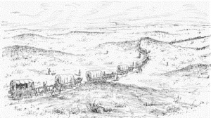
The time was, surveyors were in the vanguard of settlement of the west. And after the first pioneers had arrived and local government was established, surveyors were still extremely important folks as the flurry of early land sales and resales took place. In fact, when Kendall County was established in 1841, one of the county officers required to be elected was the county surveyor.

"Lincoln the Surveyor," a painting by Fletcher C. Ransom for a series of calendar pictures for the Illinois & Midland Railway Company, based on the life of Abraham Lincoln and completed. This image was completed in 1937 and shows Lincoln using a circumferator to survey the hamlet of Petersburg on the Sangamon River just north of New Salem in 1836.

“Lincoln the Surveyor,” a painting by Fletcher C. Ransom for a series of calendar pictures for the Illinois & Midland Railway Company, based on the life of Abraham Lincoln and completed. This image was completed in 1937 and shows Lincoln using a circumferator to survey the hamlet of Petersburg on the Sangamon River just north of New Salem in 1836.

Kendall’s first county surveyor was Archibald Sears. One of his successors was Lancelot Rood, one of my all-time favorite historical names. It’s also interesting that “rood” was an early surveying term, the name for a measure of 16.5 feet, later called a rod. Rood derives from the Old English word for “pole,” another old surveying term for a rod.

Those earliest surveyors in northern Illinois measured the land using a variety of simple tools, far less complicated than modern laser sights and GPS mapping in use today. The main tool was the surveyor’s chain. The chain was 66 feet long (four rods—or roods or poles) and was comprised of 100 links, each 7.91 inches in length.

The chain was not only the basis for surveys of open country, but here in the Fox Valley and beyond, the basis around which towns were laid out. Here in the old Village of Troy where I live (which was annexed by Oswego in the early 1990s), lots were laid out 66 feet wide and 132 feet deep. Streets were also 66 feet wide, except Main Street, which was 100 feet wide. Alleys were one rod—16.5 feet—wide.

Those measurements are pretty much standard throughout our region. Not so in all regions, of course. In Ottumwa, Iowa, for instance, lots are 50 feet wide, which leads to a dense cityscape.

19th Century surveyors physically measured land boundaries with chains like this. The chain was 66 feet long and consisted of 100 links, each 7.92 inches long. In many Fox Valley communities, city lots are one chain (66 feet) wide and two chains deep.

19th Century surveyors physically measured land boundaries with chains like this. The chain was 66 feet long and consisted of 100 links, each 7.92 inches long. In many Fox Valley communities, city lots are one chain (66 feet) wide and two chains deep.

The pioneer surveyors who first measured the land and then used those measurements to map the area, laid out the basic grid on which all future land surveys were based. The system was mandated in the Northwest Ordinance of 1787, an invention of Thomas Jefferson, who, as the Illinois Professional Land Surveyors Association points out, is one of three former surveyors whose faces now adorn Mt. Rushmore (Washington and Lincoln were the other two).

According to Jefferson’s system, surveys of all new government land were to be based on a grid system of one-mile square sections, each 640 acres. Thirty-six sections comprised a surveyed township, multiples of combined to create counties and states.

Surveys aren’t measurements randomly spotted about the landscape, of course. They have to be measured from standard baselines. In the case of the Public Land Survey that measured the land in the Northwest Territory (basically everything west of the Mississippi and north of the Ohio River), initial survey lines were located based on east-west baselines and north-south principal meridians.

Here in northern Illinois, surveys were measured west from the Third Principal Meridian, which extends due north from the mouth of the Ohio River, and north of an east-west baseline bisecting Illinois from a point just south of Allendale on the Wabash River. Surveyed townships are six miles square, containing 36 sections, each of which is one square mile.

The first survey in Kendall County was to mark the boundaries of the Illinois & Michigan Canal cession. According to the Treaty of St. Louis of 1804, the cession was to consist of all the land inside boundaries lying 10 miles east and west of the course of the combined Chicago, DesPlaines, and Illinois rivers all the way to Ottawa. In 1818-1819, Surveyor John C. Sullivan set stakes on the shore Lake Michigan and ran the canal cession boundaries, which forever after was known as the Indian Boundary Line.

It enters Kendall County on a roughly 45° angle along the east central border of NaAuSay Township at Walker Road and then makes a west-southwest dogleg in about the middle of Seward Township before exiting the county along modern U.S. Route 52 on the southwestern border of Big Grove Township.

The Mo-Ah-Way and Waish-Kee-Shaw reserves were some of the earliest parcels surveyed in Kendall County. The two adjoining parcels are located in modern Oswego and NaAuSay townships.

The Mo-Ah-Way and Waish-Kee-Shaw reserves were some of the earliest parcels surveyed in Kendall County. The two adjoining parcels are located in modern Oswego and NaAuSay townships.

Two other Kendall County parcels were surveyed before the vast majority of the county was surveyed in 1837 and 1838. In the Treaty of 1829 at Prairie du Chien, Wisconsin with the local Three Fires Confederacy, reserves were granted to individuals, 160 acres to Mo-Ah-Way and 960 acres to Waish-Kee-Shaw, the Pottawatomie wife of Indian trader David Laughton.

By law, public land could not be sold until it had been surveyed and mapped by the U.S. Government Land Office. So because land south of the Boundary Line and in the two reserves had been officially surveyed and mapped, it was available for sale much earlier than the rest of Kendall County, which was not put up for official sale at the federal land office in Chicago until 1842. The earliest parcel sold seems to have been the 128 acres in the southwest quarter of Section 30 of Big Grove Township bought by Edmund Week in September 1829.

Late in 1837, U.S. Government surveyor Eli Prescott was tasked with laying out the line running west from Lake Michigan at Chicago that eventually became the boundary line between Kendall and Kane counties.

Prescott anchored his line at the point established by Sullivan’s 1818 survey. His first task on Sept. 22. 1837 was to adjust his compass by taking a sight on the North Star. The next day he located the point on the lakeshore established by Sullivan in 1818 at modern Evanston. “Readily found the old bearing trees of the commencement of said line at this point,” he wrote in his notes. “But with extensive digging in the accumulated sand banks from the lake at this corner can find no vestige of the old corner post.”

Surveyors set corner posts and then as a backup, blazed and described nearby trees—Prescott’s bearing trees. Prescott also found some errors in Sullivan’s work, which he attempted to correct before running his baseline. By Oct. 5, 1837, Prescott’s survey crew was surveying what would one day be the border between Kane and Kendall counties.

The survey of the rest of Kendall County began the next year, with one of Prescott’s former chainmen, James Reed, doing the actual survey work. It fell to him to try to work the lines surveyors ran in 1818 and in the 1820s matched into the new survey lines. In that he was only partially successful. For instance, the western border of Oswego Township misses the western border of Aurora Township in Kane County by almost 1,100 feet, making Oswego Township’s Section 6 measure only about 431 acres instead of the 640 acres it should be. The surveyors accommodated the old lines, finding their new moved slowly west. By the time the line reached the extreme southwest corner of Seward Township, the border section had grown to 540 acres.

For those of us who enjoy trying to figure out why things are as they are, all those little kinks and jogs that mysteriously appear on modern maps are reminders of the past’s physical influence on 21st Century life.

2 Comments

Filed under Illinois History, Kendall County, Local History, People in History, Technology

Were Pa, Adam, Hoss, and Little Joe from Illinois?

The late 1950s were the heyday of television westerns, and one of the most popular during that era was “Bonanza,” the tale of fictional Ponderosa Ranch owned by the Cartwright family—father Ben (a widower) and sons Adam, Hoss, and Little Joe.

Was the Cartwright family of "Bonanza" fame based on a 19th Century Illinois family? Could be...

Was the Cartwright family of “Bonanza” fame based on a 19th Century Illinois family? Could be…

Their spread was located in the mountains near Nevada’s Lake Tahoe, where the family earned their living logging, raising cattle and selling supplies to the miners working on the huge silver strike called the Comstock Lode.

Lots of people enjoyed the interaction between the three brothers and their father, and the rest of the cast of characters, from the Chinese cook Hop Sing to Virginia City Sheriff Roy Coffee. So many, in fact, that “Bonanza” was number one in the ratings for four years running. It’s still playing in syndication.

What has interested me for years now is whether or not the saga of the Cartwrights might not have been, in part at least, based on a real-life family from Illinois that emigrated west in the 1840s. The patriarch of that family would have been well known to Kendall County’s pioneer settlers—by reputation if nothing else.

When the son of William and Katherine (Devers) Winters was born in 1794 in Pennsylvania, they named him John Devers Winters, his middle name honoring his mother’s family. Little is known of his early life, but he eventually arrived in Illinois, probably from the South. Former U.S. Secretary of State Elihu B. Washburne writing 30 years after the fact, said he believed Winters came “from either Kentucky or Tennessee,” before settling in northern Illinois with his wife, Elizabeth. Winters’ first son, Theodore, was born in Illinois in 1823. Before Elizabeth’s death, the couple had three sons, Theodore, John D. Junior, and Joseph (Little Joe?), along with two daughters, Amanda and Harriet.

In the 1830s and 1840s, the arrival of the mail stagecoach was an exciting community event, as this illustration from Stage-Coach and Tavern Days by Alice Morse Earle (1902) suggests.

John D. Winters engaged in the boisterous stagecoaching business in Illinois starting in the 1830s. Eventually, the Frink & Walker combine drove him out of the state to California. The arrival of the mail stage in Illinois’ small towns was a notable event, as this illustration from Stage-Coach and Tavern Days by Alice Morse Earle (1902) suggests.

Winters probably settled first in southern or central Illinois, possibly around Peoria. In 1827, Winters moved north to what would eventually become Jo Daviess County with James and John Flack. Shortly thereafter, Winters and Capt. Clack Stone (whose first name is, understandably enough, often incorrectly spelled “Clark”), established a village they named Elizabeth after Winters’ wife (Elizabeth is located on modern U.S. Route 20 a few miles southeast of Galena).

Winters apparently got into the freight, mail, and stagecoach business almost as soon as he arrived in Illinois. From his new base in Elizabeth, he began running coaches from Galena south to Peoria and St. Louis.

Dr. John Taylor Temple initiated stage service from Chicago to Ottawa, and from there to Peoria, in January 1834, using his political connections to obtain the mail contract, a must for any successful stage operator. Winters bought Temple out in the spring of 1837 but then lost the Chicago mail contracts to John Frink and his partners later that year.

Winters subsequently abandoned Chicago for greener pastures elsewhere in the state, concentrating on the Peoria to Galena and other lines in western and northwestern Illinois. Sharp increases in passenger and mail business between Chicago and Galena and other points in Illinois in the early 1840s led to Winters and Frink locking horns one more time. Frink’s coaches sported a wheel brake, a sensible safety device, but Winters denounced it as a “Damn Yankee contrivance,” and said he didn’t want anything holding his horses back. Frink fired back that Winters used old broken down horses. Winters then made a tactical error in advertising that passengers in his coaches traveled “leisurely over the prairies.” Frink replied his stages were pulled by lively horses and that due to their speed, space “was almost annihilated.” In the end, Winters braced Frink in the American House hotel in Galena and the two fought it out.

But Frink and his partner, Martin O. Walker, prevailed. In 1848, Winters gave up, sold out, and moved his family west to California. It turned out to be the first of a couple very fortuitous turns of events. Shortly after arriving in California, gold was discovered at Sutter’s Mill. Winters and his sons, all skilled teamsters, made their first fortune hauling supplies to the gold fields.

The popular view of wagon trains has them populated by emigrant families moving west to new homes. But the vast majority of the trains heading west from Independence, Mo. and east from California hauled freight, not pioneers.

The popular view of wagon trains has them populated by emigrant families moving west to new homes. But the vast majority of the trains heading west from Independence, Mo. and east from California hauled freight, not pioneers.

Then when gold was discovered in Nevada, the Winters clan started hauling supplies from Placerville, Calif. to the Carson Valley in Nevada. It was about that time that old J.D. decided to take a chance in the mining game and he bought an 18th share in a new mine called the Ophir. It was a fateful decision because the Ophir was one of the mines burrowing into what became known as the Comstock Lode, a silver deposit so huge that it was almost incomprehensible. Wrote Sam Clemmens (who eventually became known as the writer Mark Twain) to his brother from Esmeralda, Nev. in July 1862, “An eighteenth of the Ophir was a fortune to John D. Winters.”

J.D. ended his life as a prominent rancher and businessman. Young J.D. Junior was elected a member of Nevada’s first territorial legislature and even ran for governor. Theodore, born all those years ago in Illinois, went on to found the town of Theodore, Calif., and was a rich man in his own right.

Although forced out of the stage and freight business in Illinois, the Winters family headed west where they were in exactly the right place at exactly the right time to make their fortune in transportation, land, and mining. Just like the Cartwrights (whose name, possibly not so coincidentally, means “wagonmaker”), except the Winters’ story started right here in northern Illinois.

3 Comments

Filed under Illinois History, Local History, Nostalgia, People in History, Transportation

We’re all from somewhere else…

One thing Americans have in common is that we’ve all come here from someplace else.

We hear a lot of grumping these days about those ‘illegal aliens’ who seem to be such a big problem for so many of those who all have immigrants in their family background. That even goes for the Native Peoples who were here to greet the first European pioneers. I’ve been reading with fascination the latest theories about how the earliest people arriving in North America came via the land bridge between Siberia and Alaska. Except now, researchers don’t think it was a relatively quick transit by nomadic hunters, but instead involved people settling and living on land that’s now under the Bering Strait for as long as 10,000 years as they gradually moved east.

The European invasion of North America started with the Vikings and their on-again, off-again settlement at Vineland, which we know today as Newfoundland. But the Norse didn’t stay long, and their brief occupation was forgotten. It wasn’t until Spanish explorers finally and once and for all established there was a whole continent blocking access to the Orient that permanent European settlements began on the North American continent. From Jamestown in 1607, the slow occupation of North America and displacement of its Native People began.

Back when I was just a kid, I listened to the stories my mother and grandmother told about my family that instilled a lifelong curiosity about history. And now that I’m officially a geezer, I’ve really been enjoying my subscription to Ancestry.com. Tracking down your family is a really good way to become familiar with United States history, at least is has been in my case. It also tends to teach a person that being angry at immigrants, legal and illegal, is, at the very least, hypocritical.

When my ancestors began arriving here, Ellis Island wasn’t even a gleam in someone’s eye. And for my earliest ancestors, neither was the United States. Instead, the process consisted of finding enough money for passage, getting to the seacoast, buying passage, and then trying to survive the trip across the North Atlantic.

My great-great-great-great-great-grandfather, Baltzer Lantz, so the story goes, got so angry with his family that, while plowing on the family land in the German Palatinate one fine day in 1752, he left the ox and plow standing in the field and stomped off in a huff. Given that branch of the family’s temper, the story is not impossible.

Thanks to links on the Zentmyer family website, we sort of know what the Phoenix looked like, and according to the Mariners Museum in Newport News, Va., this is likely a pretty close approximation.

Thanks to links on the Zentmyer family website, we sort of know what the Phoenix looked like, and according to the Mariners Museum in Newport News, Va., this is likely a pretty close approximation. Ship-rigged (square sails on all three masts, plus a fore-and-aft driver on the mizzen) and flush decked, the Phoenix made a number of trips from Europe to North America.

But whatever the reasons, Baltzer made his way to Rotterdam on the North Sea coast, where he took passage to North America aboard the British flag passenger ship Phoenix, Capt. John Spurrier, master. The Phoenix appears to have been a flush-decked ship-rigged merchant vessel capable of transporting as many as 375 passengers plus crew. After leaving Rotterdam, the Phoenix took a southwesterly course down the English Channel, made a stop at Portsmouth, and then headed across the Atlantic.

Baltzer arrived at the busy port of Philadelphia on November 2, 1752. From Philadelphia, Baltzer seems to have worked at his trade as a mason, eventually enlisting to fight in the French and Indian War helping build fortifications. After the war he settled in Lancaster, Pennsylvania and was a solid citizen of the town until his death in 1812.

So much for the antecedents on my mother’s mother’s side of the family. My mother’s father’s parents, the Holzhueters, came over relatively late, arriving—again from Germany—in 1885. My great-grandfather was a man of position in East Prussia, working as a gardener at one of the Kaiser’s palaces at Koningsburg. My great-grandmother’s family, the Tesches, had come to the U.S. in the early 1880s, settling in Aurora, Illinois, and they sent back glowing letters to the Holzhueters, reportedly telling them the streets in America were almost literally paved with gold.

The SS Eider was built for the Atlantic immigrant and passenger trade for the North German Lloyd Line. She didn't even last 10 years before she fetched up on a shoal off the Isle of Wight.

The SS Eider was built for the Atlantic immigrant and passenger trade for the North German Lloyd Line. She didn’t even last 10 years before she fetched up on a shoal off the Isle of Wight.

So, in April 1885, the Holzhueters, consisting of Wilhelm and Fredericka (Tesch) and their three children, Bernhold , age 3; Gustav, age 2; and Anna, just two months old, made their way west to the ancient Hanseatic League port of Bremen on the River Wesser. There, they took passage aboard the fast steamer Eider.

The Eider was a new ship, launched just a few months before on Dec. 15, at the John Eider & Company shipyard at Glasgow, Scotland. Iron hulled with four masts and two funnels, she was built for the North German Lloyd Line, a German flag carrier. At 4,719 tons berthen, the Eider measured 430 feet in length and 47 feet on the beam. She was propelled by one compound steam engine and a single screw. Built as one of four steamers in the Rivers class, she was designed for both comfort and speed, and could maintain 17 knots while carrying a full load of 167 crew and 1,250 passengers—125 in first class; 125 in second class; and 1,000 in third class. The Eider eventually cut the time for crossing the Atlantic from Southampton, England to slightly over seven days.

In April 1884, the Eider left the wharf at Bremen and headed down the Wesser, past Bremerhaven, and out into the North Sea. She then set a course west into the English Channel, steaming past Portsmouth where, 130 years before, the Phoenix with Baltzer Lantz aboard made a stop, and made port at Southampton, England. After a brief stop, she then headed back southeast down the Southampton Water to the Channel, before heading west across the Atlantic. The Holzhueters arrived at the port of New York on 26 April 1884. There, they were checked through New York State’s Castle Garden Immigration Depot in lower Manhattan, having arrived six years before the Federal Government assumed immigration control from the State of New York, and eight years before the Ellis Island facility opened.

From New York, the Holzhueters traveled west by train to Aurora where their Tesch relatives had arranged places for them to stay. They soon found the whole “paved with gold” thing was hooey, but Wilhelm and Fredericka, through hard work, were able to make a comfortable life for themselves.

It's likely the Harvest Home looked a lot like this bark from the 1880s. Barks have three masts with square sails on the first two masts and triangular fore-and-aft sails on the mizzen.

It’s likely the Harvest Home looked a lot like this bark from the 1880s. Barks have three masts with square sails on the first two masts and triangular fore-and-aft sails on the mizzen.

On my dad’s side of the family, his grandparents, Henri Francois and Virginie (Ducommun-Dit-Veron) Matile along with their six children, Laura, 12; Anna, 10; Ferdinand, 9; Emma, 6; Alma, 4; and Cesar, 11 months, decided it was time to leave the French-speaking Neuchâtel region of Switzerland in 1867. Making their way to the port of LeHarve, France, they were among 127 passengers who booked passage aboard the Harvest Home with Capt. D.N. Berry in command.

The Harvest Home was a 598-ton wooden-hulled bark of U.S. registry. Barks are three-masted sailing vessels with square sails on the fore and main masts and triangular fore-and-aft sails on the mizzen mast.

A veteran of the Atlantic run, the Harvest Home arrived at the port of New York on Aug. 3, 1867. From there, the Matiles made their way west to Erie, Pennsylvania where Henri Francois pursued his trade as a watchmaker. After having two more sons—including my grandfather—Virginie died a few years after they arrived in the U.S. Henri Francois remarried Georgia Anna Swinrow, moved his family to the wide open spaces of Kansas, and had a bunch more kids.

When it comes to the antecedents of my grandmother on my father’s side—the Mitchells—I’ve struck out finding when they arrived on these shores. It was certainly before the Civil War, because my great-grandfather served in a 100-day Ohio infantry outfit. I keep searching and with luck one of these days I’ll find out when the first Mitchell got here.

Of the three ships that carried my ancestors to North America, at least two were wrecked. The Phoenix came to grief at Casco Bay in 1758 while enroute to Boston. The Eider, which brought the Holzhueters to America, went aground on the Atherfield Ledge just off the Isle of Wight after leaving Bremen on Jan. 31, 1892. While she didn’t sink, she had to be scrapped afterwards. The Harvest Home made a number of trips on the Atlantic run, and just sort of sailed off into history.

So as I said above, everybody here has come from somewhere else. And I’d say those of us who know who we are descended from and when our ancestors were lucky enough to make it her are pretty lucky folks.

Leave a comment

Filed under Illinois History, Local History, People in History, Transportation